

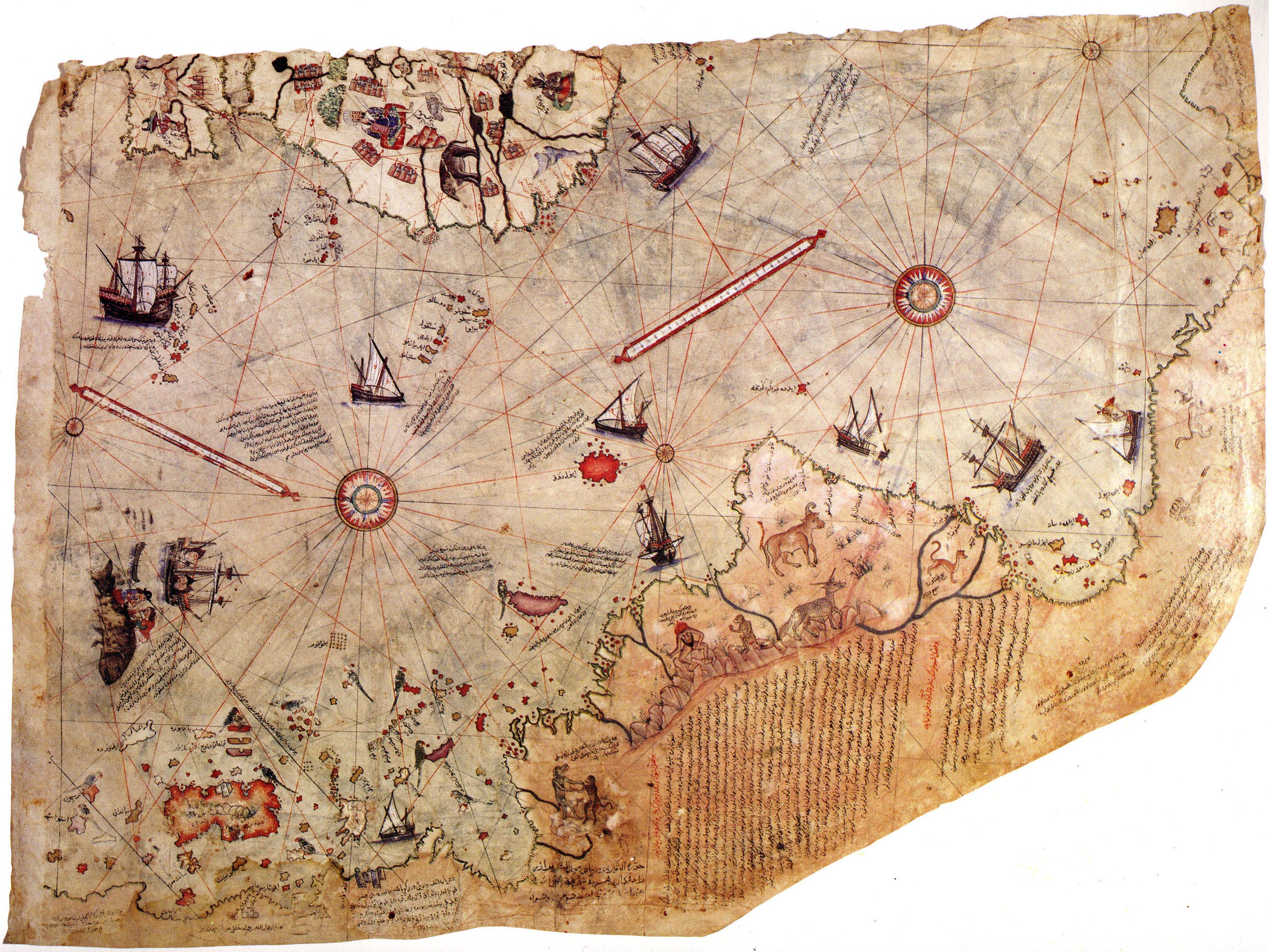
The Piri Reis Map

Take a look at this fragment of a 16th century map of the world. In particular the large landmass across the bottom:
Does this look like the coastline of Antarctica? It does look a bit like Antarctica. Maybe it could be Antarctica, let me Google it.
Aha, lots of people are saying it is Antarctica, but before it was covered in ice. Considering that was millions of years ago, this is astonishing right? How could humans know what it looked like long before humans were around? Maybe our timeline of human evolution is completely wrong. Maybe our understanding of human history and civilisation is completely wr…
Huh, what’s that? Oh, sorry. Let me turn it the right way around:
Oh, that is clearly South America. Never mind.
Since our recent post about Flint Dibble’s appearance on the Joe Rogan Experience, I have been watching on as many people have engaged with the broader evidence for a hypothetical civilization that dates to the ice age. One of the most common to be named is a very important - and very real - map named after its author Piri Reis, an Ottoman admiral (a Reis) who drew it in 1513. It only partially survives and the fragment that attracts all of the attention is the one above, which covers the southern part of the Atlantic Ocean.
This map holds particular resonance with me because back in my misspent youth I remember learning about it as proof of lost human knowledge. First by a math teacher who brought it up while covering a biology class - and no, it didn’t really fit with anything we were learning about that day. I then remember it often coming up when I would read pseudo-history books - I was a bit of a fan. How times have changed!
My teacher argued, much like many people continue to do, that the Piri Reis map shows the landmass of Antarctica before it was covered in ice. Something that is impossible if we use conventional timelines of human history. The logical conclusion being that all of our timelines are wrong. But this idea is based on two problematic trends: the first, as you saw, is that it often requires you to spin the map so that it is facing the wrong way; the second is that you also have to ignore the Piri Reis’ notations that go with it.
The landmass that is thought to be Antarctica has notations describing its hot climate, and the presence of snakes (see translations of all of his notes by clicking here, this one is labelled X):
This country is a waste. Everything is in ruin and it is said that large snakes are found here. For this reason the Portuguese infidels did not land on these shores and these are also said to be very hot
Two things which make very little sense if this was the south pole, but would be very suitable things to note about the newly discovered South American coast.
However, believers will point out that, even with the map being correctly orientated, there is still an odd landmass to the south of the Atlantic that runs east along the page. What is this if not Antarctica?
Map Traditions
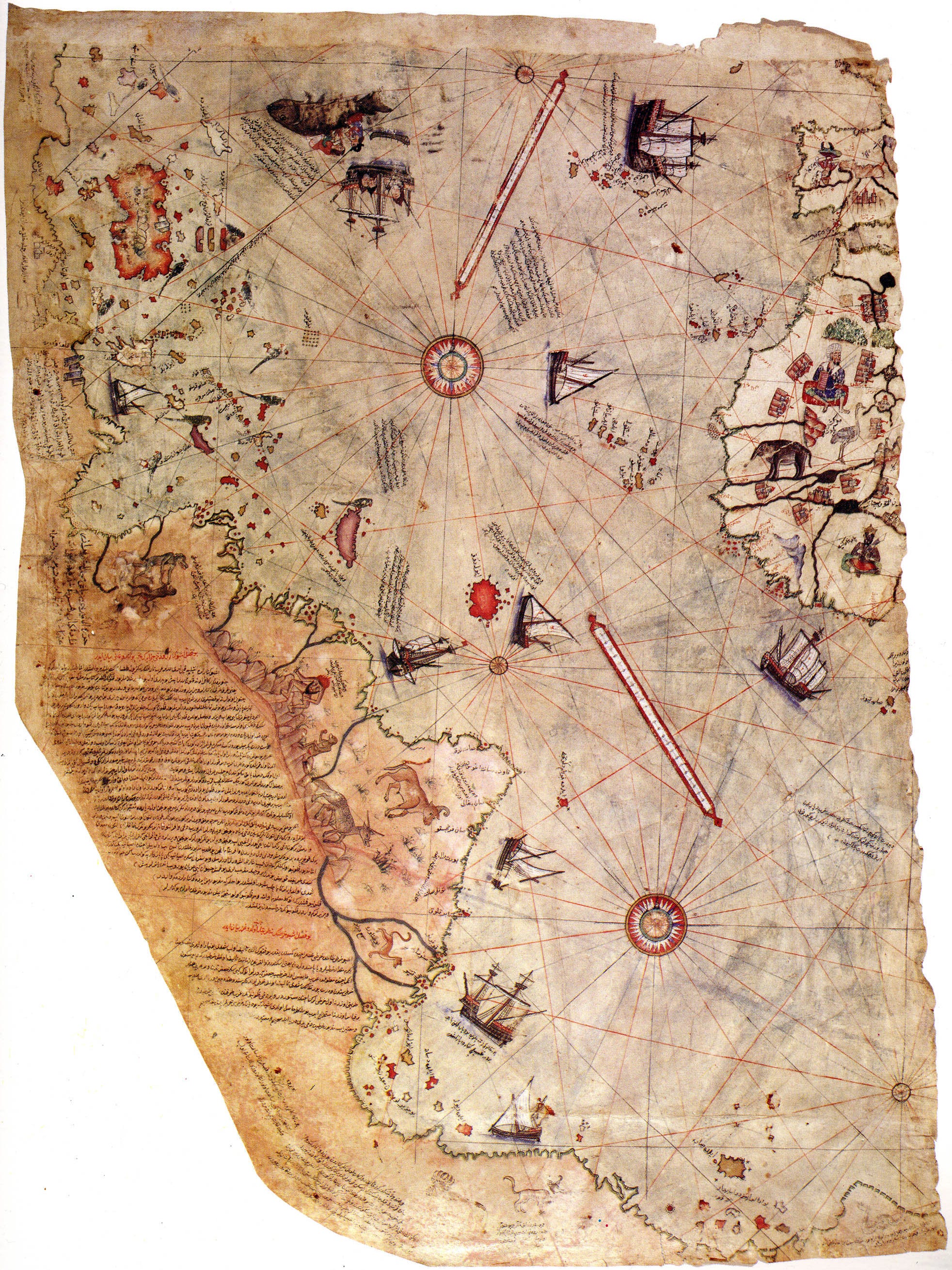
Piri Reis did not draw a map based on his own explorations. He used numerous older maps to help him, bringing together both old and new models of the world to construct his own. We know, because he lists them for us, that Piri Reis used maps from the ancient geographer Ptolemy, alongside Arabic maps, contemporary Portuguese maps, and also a map of the Americas used by Christopher Columbus himself.
The description of large snakes that I quoted above is not unique to Piri Reis, and we have other contemporary maps who make similar observations and locate them at this southern land mass as well - which must surely be a more southern part of Brazil.
It is important to remember that he was part of mapping traditions that go all the way back to the ancient world. In fact, the idea that there was a southern continent was an ancient one. So this land he depicts is not ‘known land’ - it is assumed to be there, but no-one yet knew either way. Early geography worked of the idea that the world was in some way balanced. So, for instance, the large river of the Nile was presumed for a long time to go south through Egypt and then turn west and out the coast of Africa, which would mirror another very large river to the north: the Danube, which goes west as well.
Some ancient geographers, who had no knowledge of the Americas, believed that the seas and oceans were encircled by land. This was an idea which particularly influence Ptolemy of Alexandria who, in turn, influenced Piri Reis’ map. Because Ptolemy thought that Europe covered the entire north of the world in land, it was assumed that the same must be true in the south. So Africa and Asia were actually linked by another continent called Terra Australis (the Southen Land).
By the time of Piri Reis, cartographers knew of the existence of the Americas and that Europe did not circle the earth uninterrupted; but he still presumed that there would be a land bridge along the south which encircled the oceans. Hence the land mass at the bottom of his map going east.
No pseudo-history required.
Note: To learn more about the Piri Reis map of 1513, I strongly recommend Gregory C. McIntosh, ‘The Piri Reis Map of 1513’ (2000)